
- The area was named Leigh’s Creek, after pioneer station worker Harry Leigh, in 1856.
- Copley Spur divides the catchments of the Lake Torrens Basin and the Lake Eyre Basin.
- South of Copley, the creeks flow into Lake Torrens.
- Leigh Creek water course is the most southerly of the creeks that flow north into Lake Eyre.
Early years
Coal was discovered and small quantities were mined by different owners from 1888 onwards.

Shaft head and surface buildings at Leigh Creek coal mine about 1900.
Photographer: Sydney Phillips
State Library of South Australia B64290
The town to support the mine in those early years was called Copley, after William Copley, an MP and Commissioner of Crown Lands.
Large scale commercial mining and Leigh Creek town began during World War II.
Premier Tom Playford wanted to make South Australia more self-sufficient for its energy needs, and less dependent on New South Wales.
He wanted to be seen not to rely on interstate energy if he was to attract business to South Australia
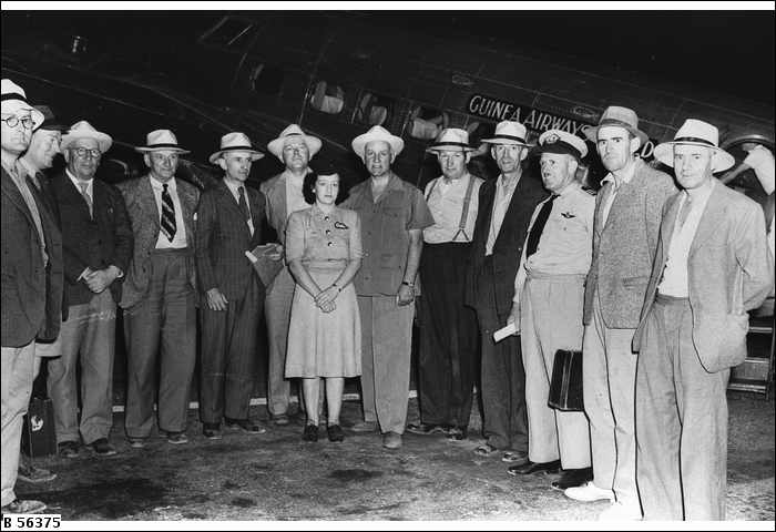
A group of people embarking on a journey to Leigh Creek coal fielding 1950. State Premier, Sir Thomas Playford, is 5th from the right – the only man not wearing a jacket.
State Library of South Australia B56372
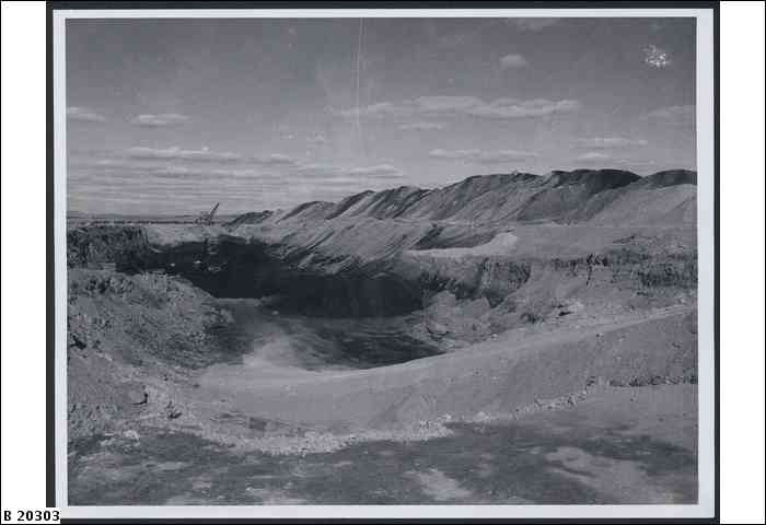
Leigh Ck coal mine 1951
State Library of South Australia B20303
Leigh Creek township 1
Came into existence in 1944, with the opening of the commercial coalfield. It had ‘almost the appearance of a metropolitan suburb that has been transported on a magic carpet and set down on a dusty plain with a background of colourful ranges’ (Mincham 1965: 281 rev. ed.).
Coal deposits extended under the town.
Leigh Creek Township 2
With mine expansion, a new town was purpose-built 13 km further south than the original town. The first families moved into Leigh Creek South in 1981. Most facilities and buildings in the present town have relatively modern designs.
Mine and railway station servicing it are near the Telford section of the coal deposits.

Leigh Creek, Copley and the Mine, 2012. Copley is 6km south of the old Leigh Creek, and the new town at the bottom of the image is 13 km from the old town, now part of the huge mine.
Water
- Access to water was a major problem.
- For a while water was carted from the Copley Dam.
- Then it was piped from Sliding Rock mine site.
- In the 1950s this was no longer enough, and the new Aroona dam was built across Scott Creek.
- Alcaroona was the Aboriginal name of this Aroona, which is not the same as Aroona Valley in the Flinders Ranges National Park, painted by Hans Heysen.
Town administration
Leigh Creek has always been administered by the owner of the mine. Owners include:
- Engineering and Water Supply Department of SA
- Electricity Trust of South Australia
- Alinta Energy (current)
Resources
Mincham, Hans 1965 rev. ed. The Story of the Flinders Ranges. Adelaide, Rigby.
Nicol, Stuart 1998 Flinders Ranges and the Mid North . Adelaide. Royal Automobile Association of South Australia.
Outback Communities Authority Submission to Standiing Committee on Regional Australia. Submission Number 155 Date received 8/12/2011 www.aph.gov.au/…/House_of_Representatives_Committees?url=/…